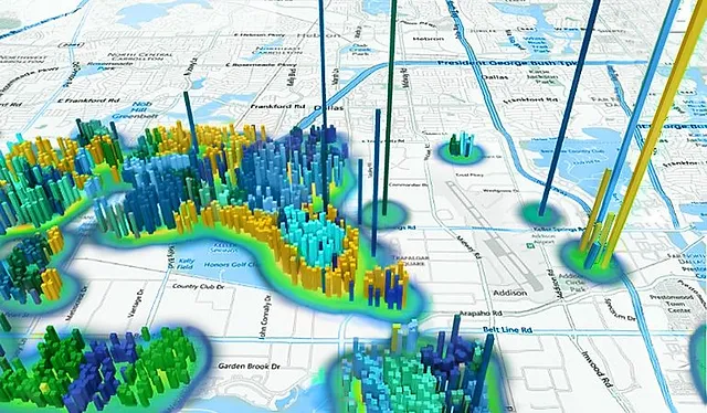
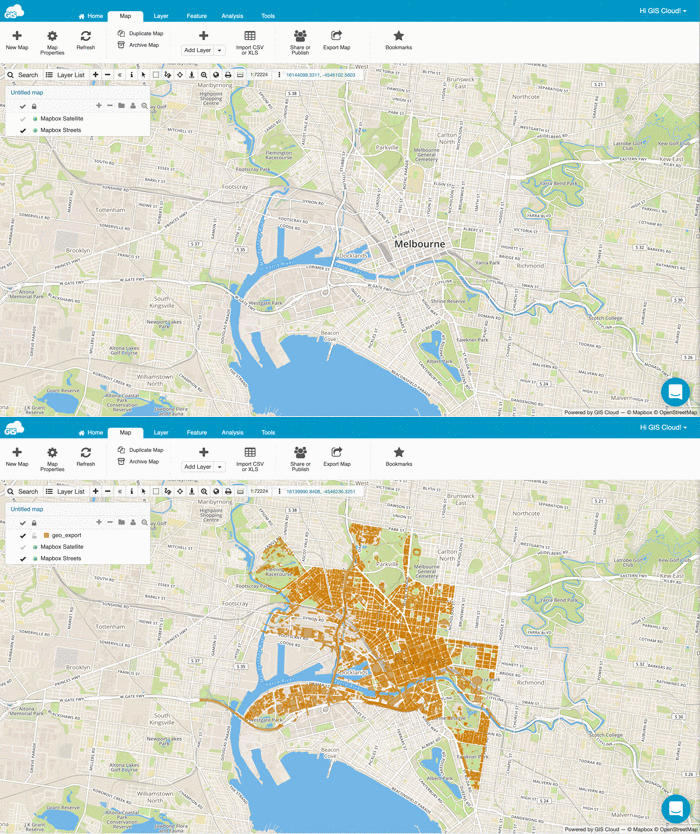
GIS (Geographic Information Systems) is a technology that captures, stores, analyzes, and manages spatial and geographic data. In Real Estate, GIS helps in mapping properties, analyzing market trends, and optimizing property management. In Agriculture, GIS supports precision farming by analyzing soil conditions, crop health, and optimizing resource use for better yields.
Need help?
(+92) 307-4065201
(+92) 307-4065201


Our Expertise in GIS Services for Real Estate and Agriculture
At Discreetsoft, we specialize in GIS services that provide advanced geographic information solutions tailored specifically for the Real Estate and Agriculture industries. Our experienced team delivers cutting-edge GIS solutions that enhance spatial analysis, property management, and agricultural planning. We create custom mapping and data analysis tools that drive efficiency and support decision-making in these critical sectors.
-
Real Estate GIS Solutions
-
Agricultural GIS Solutions
-
Spatial Data Analysis
-
Custom Mapping Solutions
-
Market Analysis for Real Estate


Elevate Your Real Estate and Agriculture Operations with Discreetsoft’s GIS Services
At Discreetsoft, we deliver advanced GIS services specifically designed to meet the unique needs of the Real Estate and Agriculture industries. Our GIS solutions offer powerful tools for spatial analysis, property management, and agricultural planning, helping you optimize operations and make informed decisions.
-
Real Estate GIS Solutions
We provide comprehensive GIS solutions for the Real Estate sector, including property mapping, market analysis, and urban planning tools to enhance property management and investment strategies.
-
Agricultural GIS Solutions
Our GIS services for agriculture offer tools for precision farming, crop monitoring, and land management, helping farmers optimize their operations and improve yield predictions.
-
Spatial Data Analysis
We deliver robust spatial data analysis capabilities to support decision-making, including terrain analysis, resource management, and environmental impact assessments.
-
Custom Mapping Solutions
Our custom mapping services provide tailored solutions to visualize and analyze geographic data specific to your business needs, enhancing your operational insights and strategic planning.
-
Location Intelligence
Leverage our location intelligence services to gain valuable insights into spatial relationships and trends, improving your decision-making processes in both real estate and agriculture.
-
Data Visualization and Reporting
We offer advanced data visualization tools and reporting capabilities to present your GIS data in an actionable format, facilitating better analysis and communication of insights.
-
Geospatial Data Integration
Our services include integrating diverse geospatial data sources to provide a unified view, enabling more effective analysis and operational efficiency in your projects.
-
Remote Sensing and Satellite Imagery
Utilize remote sensing and satellite imagery to gather and analyze geographic data, supporting accurate monitoring and assessment for both real estate and agricultural applications.
-
Urban and Rural Planning
Our GIS solutions assist in urban and rural planning by providing tools for land use analysis, infrastructure planning, and environmental management.
-
Precision Agriculture Tools
We offer precision agriculture tools to optimize farm operations, including soil analysis, crop health monitoring, and yield forecasting to improve productivity and sustainability.
Discreetsoft's GIS Solutions for Real Estate and Agriculture
Real Estate Mapping & Analysis
We offer advanced GIS mapping and analysis services for the Real Estate industry, including property valuation, market analysis, and urban planning solutions.
Agricultural GIS Solutions
Our GIS services for agriculture include precision farming tools, crop monitoring, and land management solutions to enhance farm productivity and efficiency.
Spatial Data Analysis
We provide comprehensive spatial data analysis services, including terrain analysis, resource mapping, and environmental impact assessments for informed decision-making.
Custom Mapping Solutions
We offer custom mapping solutions tailored to your specific needs, providing detailed visualizations and analyses to support strategic planning and operational efficiency.
Location Intelligence
Our location intelligence services help you gain insights into spatial relationships and trends, enhancing your strategic decisions and operational effectiveness in real estate and agriculture.
Data Visualization & Reporting
We create detailed visualizations and reports of your GIS data, enabling effective analysis and communication of insights to support your business objectives.
Ask a Question
Discreetsoft's GIS Services for Real Estate and Agriculture
-
01
What is GIS in the context of Real Estate and Agriculture?
-
02
How can GIS improve decision-making in Real Estate?GIS enhances decision-making in Real Estate by providing detailed spatial analysis, visualizing property data, and analyzing market trends. It enables better site selection, market analysis, and property management through advanced mapping and data visualization tools.
-
03
What are the benefits of GIS in Agriculture?In Agriculture, GIS offers benefits such as precision farming, crop monitoring, and resource management. It helps farmers analyze soil health, track crop performance, and optimize irrigation and fertilization practices, leading to improved yields and sustainable farming practices.
-
04
How does Discreetsoft implement GIS solutions for Real Estate and Agriculture?Discreetsoft implements GIS solutions by developing tailored applications that integrate with existing systems, providing spatial analysis, mapping, and data visualization tools. For Real Estate, we create property management and market analysis tools. For Agriculture, we develop precision farming solutions and resource management systems.
-
05
What technologies does Discreetsoft use for GIS in Real Estate and Agriculture?Discreetsoft uses a range of technologies for GIS including ArcGIS, QGIS, and custom GIS platforms. We integrate these technologies with data analytics tools and spatial databases to provide comprehensive solutions tailored to Real Estate and Agriculture sectors.
-
06
How can GIS help in property valuation?GIS assists in property valuation by providing detailed spatial data such as location analysis, proximity to amenities, and historical property trends. This information helps appraisers and investors make informed decisions based on comprehensive geographic insights.
-
07
What role does GIS play in sustainable agriculture?GIS plays a crucial role in sustainable agriculture by analyzing environmental conditions, optimizing resource use, and monitoring crop health. It supports practices such as precision agriculture, reducing waste and promoting environmentally friendly farming methods.
-
08
How does Discreetsoft handle GIS data integration?Discreetsoft integrates GIS data by combining spatial data with other data sources through robust APIs and data management systems. We ensure seamless data flow and consistency, providing unified and actionable insights across your Real Estate or Agricultural projects.
-
09
What types of GIS data can Discreetsoft handle?Discreetsoft can handle a variety of GIS data types including vector data (points, lines, polygons), raster data (satellite imagery, digital elevation models), and attribute data. We process and analyze these data types to deliver comprehensive GIS solutions tailored to your needs.
Connect with Us Instantly!
Chat on WhatsApp for Quick Assistance